
San Bernardino ZIP Coverage, Row by Row
The working ZIP code directory separates eight present delivery or institutional rows from older or ancillary numbers. A 2024 USPS local release says the San Bernardino postmaster manages six post offices and specifically identifies 92401, 92404, 92405, 92407, and 92411 in that delivery grouping. Official addresses and state ZIP material support the remaining rows below. Area language is useful orientation, not a USPS boundary claim. Verify any individual address with the USPS city and state ZIP lookup.
| ZIP | Areas covered | Post office | Notes |
|---|---|---|---|
| 92401 | Downtown and civic core, central San Bernardino | San Bernardino Main Office grouping; City Hall uses 92401 | Street-delivery ZIP with downtown institutions and municipal offices |
| 92404 | North and east-central city, Del Rosa and Highland Avenue side | Del Rosa Post Office, 1663 E. Date Place | ZIP edges should not be treated as city limits |
| 92405 | North-central city, Muscoy and University Parkway transition, Arrowhead corridors | USPS San Bernardino postmaster grouping | Distinguish nearby unincorporated Muscoy parcels with county GIS |
| 92407 | Northwest and north city, Cal State San Bernardino, University District, Verdemont direction | USPS San Bernardino postmaster grouping | Broad northern ZIP; verify each address |
| 92408 | South and southeast city, Hospitality Lane, Inland Center, industrial-commercial corridor | San Bernardino Main Office grouping | Street-delivery ZIP; ARC's nearby campus uses 92415 |
| 92410 | West, central, and south-central city corridors | San Bernardino Main Office grouping; Feldheym Central Library uses 92410 | Pair a modern parcel with California Room address sources |
| 92411 | West San Bernardino | USPS San Bernardino postmaster grouping | Standard delivery ZIP |
| 92415 | County Government Center and county-campus addresses near Arrowhead Avenue and Hospitality Lane | County campus addresses at 222 W. Hospitality Lane and 385 N. Arrowhead Avenue | Institutional and government-oriented; do not infer residents |
Historical USPS groupings also list 92402, 92403, 92406, 92409, 92412, 92413, 92416, 92418, and 92427. They are not advertised here as current residential coverage without an address-level USPS result. A 2008 labeling-list revision grouped 92402 with 92401, 92406 with 92405, 92413 with 92404, and 92427 with 92407. Those pairings show why an old ZIP reference needs a current address check.
Note: USPS orientation rows narrow a search, but only an address-level check confirms a current deliverable ZIP.
USPS ZIP Scale in San Bernardino
Postal scale adds context to San Bernardino ZIP research, but it is not a population table. The 2024 USPS statement reports 110 delivery routes, nearly 81,000 delivery addresses, and more than 8,600 post-office boxes under the local postmaster. It also describes six post offices in the San Bernardino grouping. Those figures measure delivery work. They do not say how many people live in a ZIP, how many households use one route, or how many parcels fall inside the city boundary.
The release names five delivery ZIPs in its San Bernardino grouping: 92401, 92404, 92405, 92407, and 92411. The working table adds 92408 and 92410 through documented Main Office associations, plus 92415 for county-campus addresses. The captured research does not provide a complete station-by-station name list for all six post offices, so the row labels stay at the evidence level recorded by USPS and official addresses.
The USPS city and state lookup provides the public validation route for a postal result.
The USPS also maintains an official ZIP-code resource for general lookup guidance. Use the live address result when a specific delivery point matters.
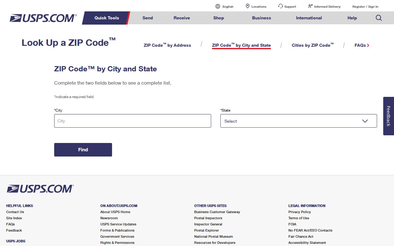
The lookup view is useful for checking a current address, while the table supplies local orientation. Keeping those roles separate prevents delivery-system numbers from being mistaken for resident totals.
San Bernardino ZIP Search Fields
A ZIP code directory works best when the postal query is precise. The research captures two USPS routes: a city-and-state lookup for the ZIPs associated with San Bernardino, California, and an address-by-ZIP workflow for checking one standardized delivery address. The live interface can change its control labels, so the table describes the documented query paths rather than promising a particular button or result layout.
| Search field or mode | Input type | Use | Boundary caution |
|---|---|---|---|
| City and state | Location pair | Find ZIPs associated with San Bernardino, California | Postal association does not establish city limits |
| Street address | Standardized address | Check the current ZIP for one delivery point | Use the precise address, not a neighborhood label |
| ZIP code | Five-digit postal code | Check address-by-ZIP results | Does not create an official resident or voter total |
For a family-history or reconnecting search, start with the address form when one is known. A city-and-state result is a coverage lead, not proof that every street with that postal name lies inside San Bernardino city. The next step is a parcel and jurisdiction check.
From San Bernardino ZIP to APN
The county's ARC Assessor Property Information route turns an address into a parcel clue. Parcel Access documents three main search modes: APN, situs or physical address, and owner name. An APN is the assessor parcel number. A situs is the physical location of the parcel. A mailing address is where assessment notices or tax bills go, and it can belong to a different owner address, business, or post-office box. The county warns that assessment data do not decide permitted use or legal ownership.
Use the parcel map to connect postal geography to the right custodian. Recorded ownership evidence follows a separate recorder index, while permits and land-use questions depend on whether the parcel is inside the city or in unincorporated territory. The postal city line is only a clue. A complete parcel result and a city or county boundary layer are stronger routing evidence.
The San Bernardino County parcel viewer shows how a selected parcel and its neighboring geometry can anchor that check.
A GIS parcel view can establish location and adjacency, but it does not turn a ZIP into a list of current occupants. Keep the APN, situs, mailing address, and legal description distinct as the search moves between systems.
A San Bernardino ZIP-to-Records Workflow
Once the postal result is known, an ordered workflow keeps each source in its proper role. The sequence below follows the local channels documented for San Bernardino.
- Verify the precise standardized mailing address and current ZIP with the USPS ZIP Code Lookup. Use the postal result as the delivery check.
- Search county Parcel Access by situs address, then click the parcel and record the complete APN. Use that parcel key when moving to assessment or recorded-document systems.
- Check a city-boundary or county-community layer to decide whether municipal permits or county land-use records apply. A San Bernardino mailing line alone does not decide that question.
- For a public business or license question, use a geography-capable register. California ABC supports all licenses for a ZIP or up to ten cities, and CSLB can search licensed contractors by city or ZIP.
- For a historical address, take the normalized street form to the Arda Haenszel California Room. Its directories, criss-cross volumes, telephone books, maps, and newspaper microfilm can bridge postal eras.
- Use the City's Browse or Online Permits route for an address, permit number, license number, or parcel number when an improvement date matters. A permit dates work, not occupancy.
When a ZIP has narrowed the area to a street, the San Bernardino street directory supplies the address-keyed next step. The ZIP layer should remain the postal and boundary layer.
Which San Bernardino Records Use ZIP Geography?
ZIP filtering is strongest for delivery validation, parcel orientation, and certain geography-based license products. It is weaker for resident identification. The county assessor map is an address and parcel tool, not a ZIP-wide resident list. The elections office separates personal voter status from controlled file access.
| Channel | ZIP-capable use | What it does not prove |
|---|---|---|
| ARC Parcel Access | Start with a situs address or APN and inspect mapped parcel data | Every person at the parcel or current occupancy |
| County GIS | View parcel boundaries and nearby geometry | That a postal ZIP equals a municipal boundary |
| My Elections Gateway | A registered voter checks personal status, locations, districts, polling place, and ballot status | An open name-and-address search; voting history is currently unavailable online |
| Qualified voter file | Permitted-purpose products, including geography reports or maps | A public directory or an official per-ZIP resident total |
The qualified voter file is limited by Elections Code section 2194. The research says an application must state a permitted election, scholarly, journalistic, political, or governmental purpose, carry an original wet signature, and be mailed or delivered in person. A qualified product may include name, residence or mailing address, status, party preference, and registration date, while protected voters are suppressed. Driver or state ID, Social Security number, signatures, and protected contact or address data remain confidential.
Requests route through the San Bernardino Registrar of Voters at 777 E. Rialto Avenue, San Bernardino, with 909-387-8300 or 800-881-8683 listed for contact. The county identifies the resources page as the place for file applications, price information, maps, and custom reports.
Note: A ZIP filter narrows geography; it does not identify every person tied to a parcel, delivery route, or mailing address.
San Bernardino ZIP Lines Meet City Lines
San Bernardino is both a city and the seat of a very large county. A postal address using San Bernardino can be affected by city, county, special-district, and ZIP geographies that do not share one outline. The countywide communities material and the City's boundary or GIS route are useful companions to the parcel map. They help answer which government holds a permit or land-use record after the postal result is known.
These terms prevent a postal label from carrying more legal meaning than it has.
- ZIP vs city boundary
- A ZIP code is a USPS delivery area. A city boundary is an incorporation or jurisdiction line. The two can overlap without matching.
- ZIP+4
- Four added digits refine a five-digit delivery address. They make routing more precise, but they do not redraw a municipal boundary.
- PO-box ZIP
- A ZIP used for post-office-box delivery rather than a normal street-delivery slice. The working table does not label an active San Bernardino row as PO-box-only.
- Unique ZIP
- A postal code assigned to one large institution or government campus. The 92415 row is treated as institutional and government-oriented, so it is not a resident count.
- Carrier route
- A USPS delivery route within a ZIP. It organizes delivery work, not a neighborhood boundary or a count of households. The 2024 local figures report 110 routes.
For a parcel inside city limits, the research routes address assignment and changes to City Community Development and Building & Safety at 201 N. E Street, with the City information line at 909-998-2000. County Land Use Services is the fallback for unincorporated territory. Assessor Services can answer parcel questions at 909-387-8307. These are jurisdiction and parcel channels, not ZIP-wide resident lists.
No official source in the research documents a citywide street-renumbering list or a named local E911 addressing unit. When an old address fails, compare the period map, directory form, parcel, and legal description instead of assuming the ZIP changed.
San Bernardino ZIP Edges and Muscoy
Local context matters when an area label sounds more exact than it is. Downtown and the civic core sit in the central grid. Del Rosa and the Highland Avenue side orient the northeast and east-central rows. The Arrowhead and foothill direction marks the northern edge, while west, central, and south-central corridors appear in 92410 and 92411. Muscoy is nearby unincorporated territory. It should not be folded into city records merely because a mailing line says San Bernardino.
The Census QuickFacts profile reports 222,101 city residents in the 2020 census and an estimated 223,728 on July 1, 2024. It also reports 62,627 households for 2019 to 2023, an average of 3.35 persons per household, 57.7 percent of residents age five and older speaking a language other than English at home, and 36.2 percent foreign-born. These are city-level measures, not ZIP-route totals. They do explain why name variants, initials, compound surnames, and alternate spacing deserve testing in a people-search workflow.
The San Bernardino County communities page provides the documented boundary and community-planning channel for local orientation.
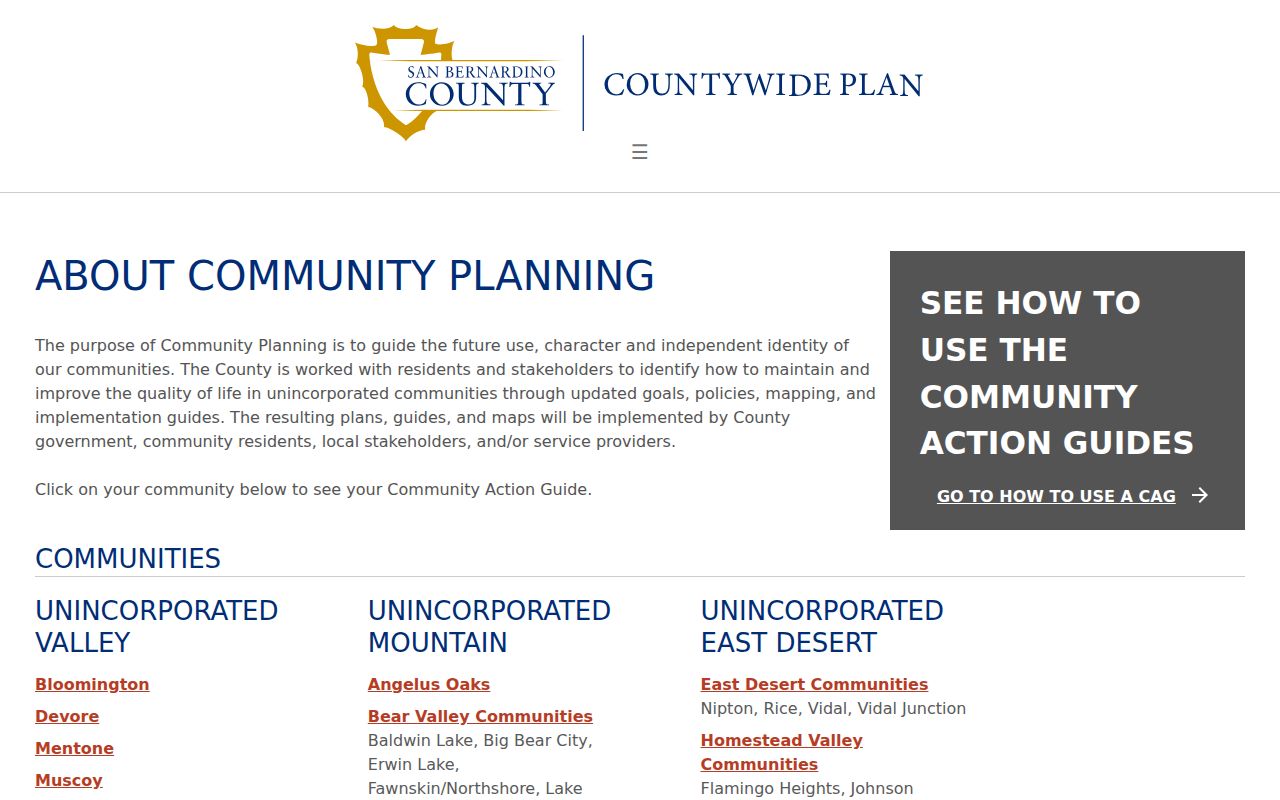
The county communities view helps separate a geographic description from a legal custodian. A parcel and its boundary remain the stronger bridge when postal and municipal labels point in different directions.
San Bernardino License Geography by ZIP
A ZIP can also be a useful geography for a public business or professional record, as long as the result is not mistaken for a household roll. The research identifies two direct examples. California ABC can return all licenses for a ZIP or for up to ten cities. The Contractors State License Board can search licensed contractors by city or ZIP. Those tools answer regulated-license questions, not who lives at every address.
- California ABC license lookup supports a ZIP-based or multi-city geography for license records.
- CSLB data portal supplies a city or ZIP route for licensed-contractor records.
- San Bernardino's Browse and Online Permits route accepts an address, permit number, license number, or parcel number for permit research.
Use a business address as an affiliation clue only. The research warns that a warehouse, agent address, or mailing point may not be a residence. Permit dates can establish an alteration or improvement, but they do not establish who occupied the building.
Follow San Bernardino ZIPs Into History
ZIP codes are a modern delivery layer. Older resident evidence is more likely to use a street, a ward, a post-office name, or a telephone exchange. The Arda Haenszel California Room at Feldheym Central Library holds San Bernardino city directories from 1887 to 1968, criss-cross directories from 1976 to the present, telephone books from 1918 to the present, early maps, newspaper microfilm, obituaries, family histories, cemetery records, church records, photographs, and San Bernardino High School annuals.
The California Room route is at 555 W. 6th St., San Bernardino, 92410. The posted room hours are Monday and Tuesday 2 to 4, Wednesday 10 to 3, Thursday 2 to 4, and Saturday 2 to 4. Call first at 909-998-4251. Mail research is listed at $20 per hour or part, plus $0.25 per page; a self-addressed stamped envelope and as precise a date as possible are requested.
Take a normalized modern street address, then ask for the older directory or map form that can bridge it. The library's early maps are especially useful when a historic address appears inconsistent with a current parcel. Newspaper and obituary material can fill gaps between directory editions, while a family album or oral history remains an attributed lead rather than a substitute for an official record.
Note: Older directories may use street names or address forms that no longer match a present postal label.
San Bernardino ZIP Directory Limits
A ZIP code directory can orient delivery geography, but it cannot supply an official count of San Bernardino residents by postal code. No official per-ZIP resident or voter-registration totals were located in the research. ZIP codes and ZCTAs are different constructs. Census tools can report ZCTA demographics, yet a ZCTA is a Census geography and should be labeled as such rather than presented as a USPS route or a City of San Bernardino count.
The California Senate's legislative ZIP directory lists ZCTAs 92401, 92404, 92405, 92407, 92408, 92410, 92411, and 92415. Its political-district percentages, including 96.4 percent for 92404 and 97.1 percent for 92408 in the cited district, illustrate that ZIP or ZCTA lines do not simply reproduce political or city boundaries. A parcel roll identifies assessed ownership and mailing destination. It does not enumerate occupants.
The sound conclusion is modest: use the ZIP to choose the next check, verify the address with the postal authority, anchor the property question to an APN and boundary, and route the final question to the custodian that actually holds the record.